Corridor reality capture

Rail Corridor LiDAR Surveys

Survey-controlled trolley, terrestrial and UAV LiDAR for railway corridors, stations, tunnels and surrounding assets.

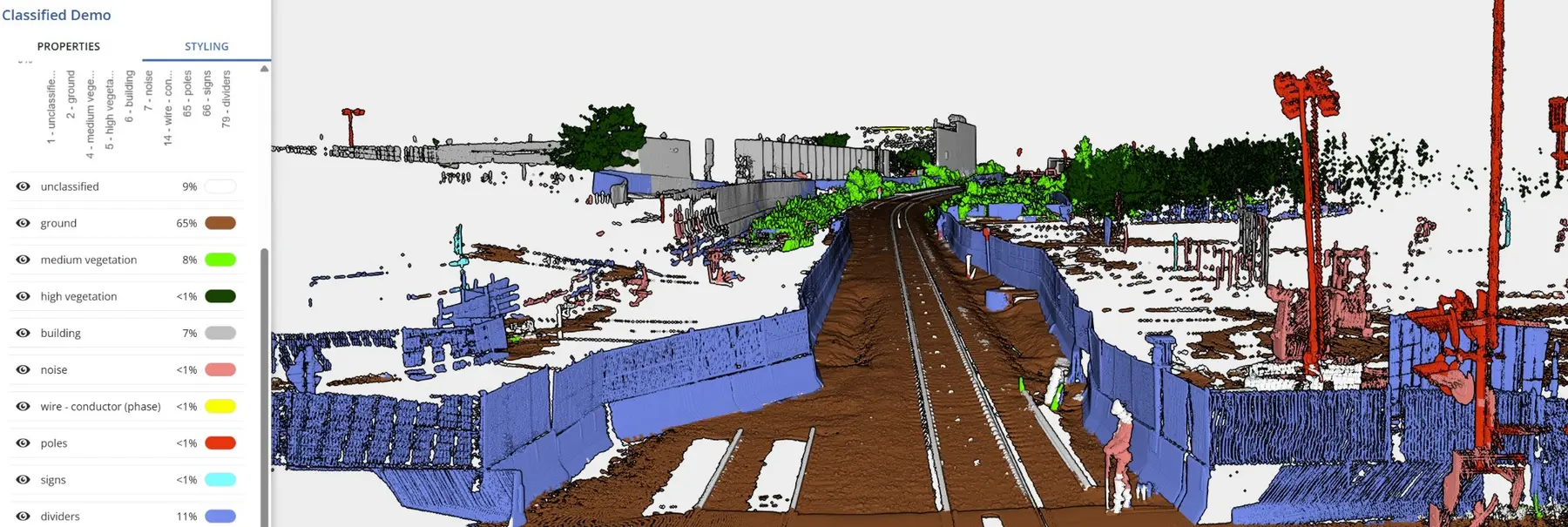
Classified LiDAR point cloud of a railway corridor

Accurate field data.
Useful project answers.

Summit selects the LiDAR platform around the railway environment and required output. Trolley-mounted, terrestrial and UAV capture can be tied to survey control and combined with measured track position to produce an engineering-ready record of the corridor and its interfaces.

Capabilities

Measured for the railway.

  • Trolley-mounted and terrestrial LiDAR
  • UAV LiDAR and photogrammetry
  • Survey control and independent checks
  • Rail-relative corridor capture
  • Point-cloud registration and classification
  • Repeat capture and change comparison

Deliverables

Ready for the project team.

  • Registered LAS or LAZ point clouds
  • Classified corridor datasets
  • CAD linework and 3D features
  • Cross sections and profiles
  • Surface and elevation models
  • Clearance and change-analysis inputs

The right LiDAR platform for the railway environment

No single scanner suits every rail project. A trolley workflow can preserve the relationship to the running rails, terrestrial scanning can capture dense station or structure detail, and UAV LiDAR can efficiently map the wider corridor and surrounding terrain.

Summit plans control, overlap, validation and deliverables before capture. This keeps the point cloud tied to the project coordinate system and focused on the engineering question rather than simply producing a large dataset.
Built around the asset
and the decision.

01Rail corridor mapping
02Stations, tunnels and structures
03Clearance and interface surveys
04Design base and asset records

Planning the
right survey scope.

Which LiDAR method is best for a rail corridor?

It depends on the required detail, corridor width, access, vegetation, structures and deliverables. Summit can combine trolley, terrestrial and UAV methods where one platform alone will not answer the project need.

Can LiDAR be coordinated with track geometry?

Yes. Measured rail position can be captured or integrated with the scan so clearance, cross sections and surrounding assets are evaluated in the correct relationship to the track.

What point-cloud formats can Summit provide?

Common deliverables include registered LAS or LAZ point clouds, classified datasets, CAD linework, sections, surfaces and project-specific outputs agreed at scoping.

Your next project

Discuss your survey
or monitoring requirements.

Summit Infrastructure Ltd.
3201 9 St SE, Calgary, AB T2G 3C1
403-629-6187
Start a conversation