Scope the access
We confirm limits, access, control, accuracy and the decision your data must support.
 Start a conversation
Rail survey services · Toronto & GTA
GEDO track surveys, rail monitoring, OCS, clearance and survey control for passenger rail, LRT and infrastructure projects across Toronto and the GTA.
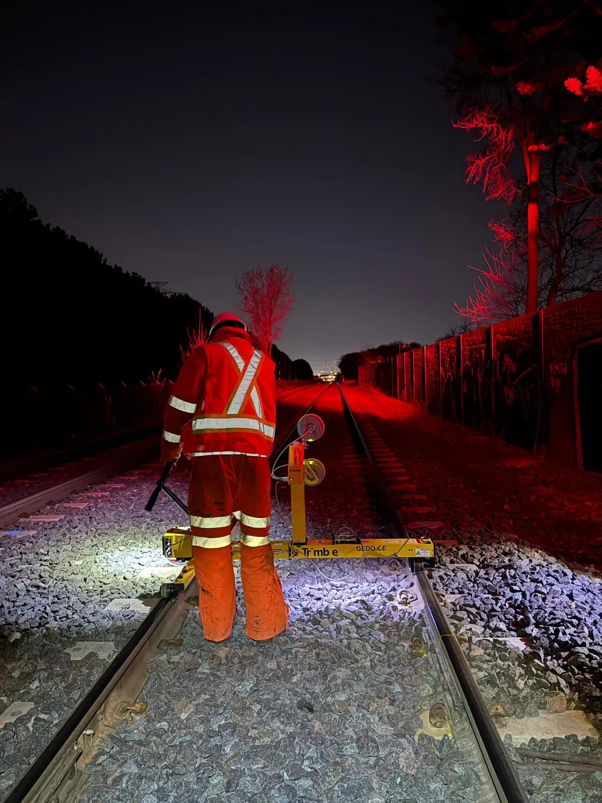
Specialized field systems, rail-aware planning and clear deliverables—from the first control point through to final CAD, reports or movement data.
High-accuracy railway track geometry, alignment, as-built and clearance surveys using Trimble GEDO systems across Canada.
↗02Rail As-Built SurveysSurvey-grade rail as-builts, 3D rail strings and design comparisons for track projects in Calgary, Toronto and the GTA.
↗03Track Construction Surveying & VerificationRail construction survey control, alignment verification and staged as-builts for track projects in Calgary and Toronto.
↗04Rail Clearance & Tunnel Envelope SurveysGEDO-based railway clearance surveys, tunnel envelopes and point-cloud analysis for freight and transit systems in Canada.
↗05OCS Height & Stagger SurveysSurvey-grade OCS wire height and stagger measurement coordinated directly to railway track geometry and chainage.
↗06Railway Survey Control & Precise LevellingRobust railway survey-control networks, GNSS, traversing and precise levelling for repeatable project delivery across Canada.
↗07Rail Corridor LiDAR SurveysSurvey-controlled trolley, terrestrial and UAV LiDAR for railway corridors, stations, tunnels and surrounding assets.
↗
Toronto delivery
Summit supports transit authorities, engineering teams and contractors with survey data that connects directly to design, construction and maintenance decisions.
Our workflows are planned around possession limits, constrained stations, tunnels and live-rail interfaces. The result is efficient field capture, clear quality control and deliverables that arrive in the project coordinate system.
Discuss your project ↗How Summit delivers
We confirm limits, access, control, accuracy and the decision your data must support.
Rail-focused crews deploy the right GEDO, total-station, LiDAR or monitoring workflow.
QA-checked outputs arrive in the required coordinates, formats and reporting structure.
Summit provides GEDO track geometry, rail as-built and construction surveys, OCS height and stagger measurement, clearance surveys, survey control and rail-corridor LiDAR for projects across Toronto and the GTA.
Yes. Field plans can be developed around short, nighttime or possession-based access, with the required control, equipment and deliverables confirmed before mobilization.
Yes. Depending on scope, outputs can include 3D rail strings, CAD data, geometry and deviation schedules, point clouds, clearance plots, OCS schedules and survey-control records.
Toronto project enquiry
Share the asset, project stage, access constraints and required output. Summit will review the scope and respond directly.
403-629-6187 →